The River That Keeps on Giving
Photos by Forrest Anderson
In the late 1880s, a French silver miner working in the high Rockies in Colorado wrote enthusiastically home to his family about the clear water and abundant trout in the rivers there. A few years later, he had saved enough money to buy a ranch on a tributary of the Colorado River, the Gunnison River. He built a fish pond on the river to raise the trout (“truite”) he was so thrilled about as well as a system of irrigation ditches to water the ranch.
I'm a descendent of this miner/rancher as well as other miners, ranchers and farmers whose lives were shaped by the Colorado River system that flows 1,450 miles from the high Rockies through the Southwestern United States and northern Mexico. The river and its tributaries shaped the history of countless families in the West and continues to do so today for millions of people. In the late 19th century, settlers built ranches and farms along the river and its tributaries to have access to water for irrigation and consumption in the arid region. In the 20th century, many people including my parents were employed by the U.S. government building mammoth dams and reservoirs to manage the system’s water. Government engineers used my rancher grandfather’s weather records, handwritten in his daily journals, as a benchmark to assess the environmental impact of changes in local temperatures caused by the Blue Mesa Dam and Reservoir. This and other reservoirs inundated pioneer ranches, farms and communities such as the one built by my miner/rancher ancestor at Iola, Colorado. My father, who was born in Iola, joked after the reservoir filled that he was born underwater. When the water in the reservoir gets low, pilots flying over could see the rooftops of Iolas' old buildings under the water.
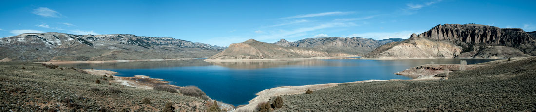
The Blue Mesa Reservoir.
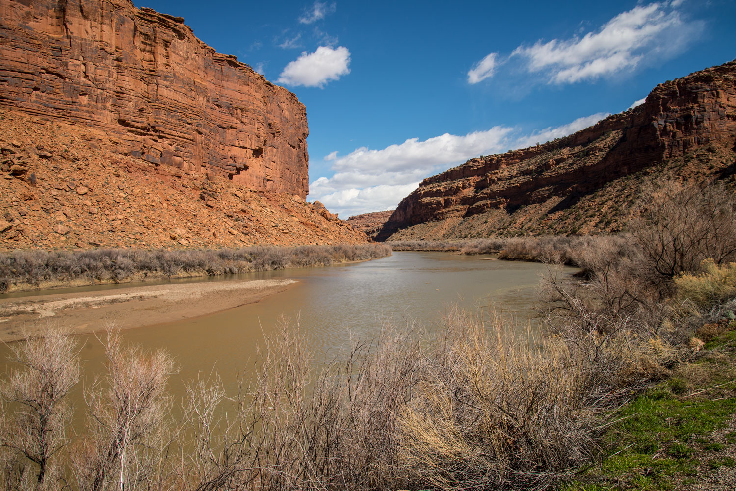
The Colorado River carves through the Western Slope of the Rockies, gaining water from tributary rivers as it goes. More than 25 large tributaries contribute to the river, adding water from not just the Rockies, but also Wyoming and Utah’s Uinta Mountains. One of the largest tributaries, the Gunnison River, joins the Colorado River at Grand Junction, a major ranching and farming region where my maternal ancestors settled. The river then cuts northwest across the desert Colorado Plateau in the Four Corners Area, enters Utah and joins the Dolores River before passing Moab, Utah. It defines the southern border of Arches National Park, flowing between sandstone cliffs and through narrow canyons.
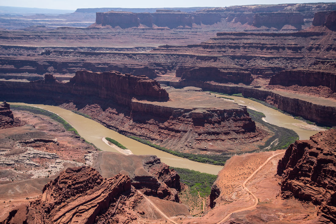
The Colorado River at Dead Horse Point, Utah, near Canyonlands.
The river snakes through some of the most rugged areas in the United States, such as this area in Utah.
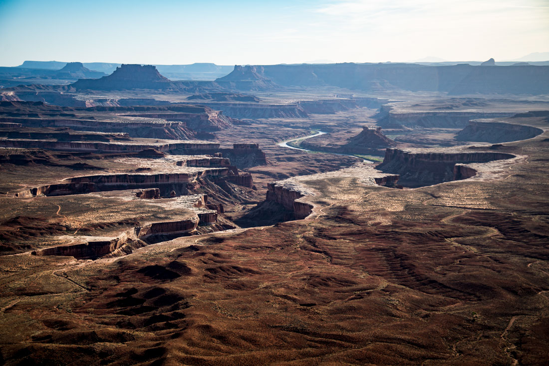
The river meets its largest tributary, the Green River, in Canyonlands National Park. The water creates the dangerous rapids of Cataract Canyon, then passes through the Navajo sandstone formations of Glen Canyon. The San Juan River joins the Colorado River here and then enters northern Arizona where the Glen Canyon Dam creates Lake Powell. The river passes by historic Lee’s Ferry where river flows are measured to apportion water to seven U.S. and two Mexican states. It passes under the Navajo Bridges at the Grand Canyon, goes through Granite Gorge and exposes 2 billion-year-old rocks as it flows through Grand Canyon National Park.
In Nevada, the river widens into Lake Mead, the continental U.S.’s largest reservoir, which was created in 1935 by Hoover Dam. It flows under the Mike O’Callaghan-Pat Tillman Memorial Bridge, which is 900 feet above the water and the highest concrete arch bridge in the Western Hemisphere.
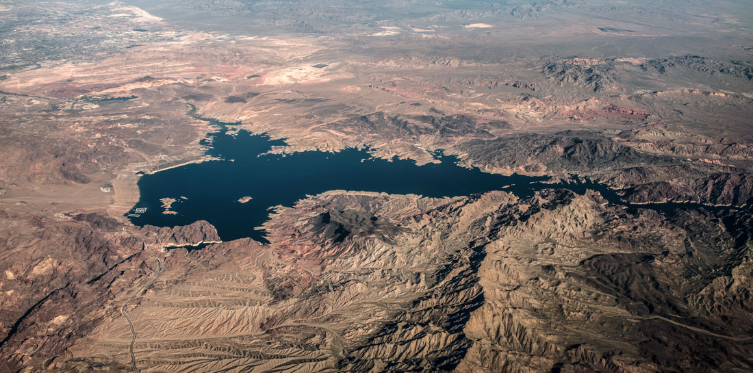
Lake Mead and, in the lower left corner of the lake, Hoover Dam from the air.
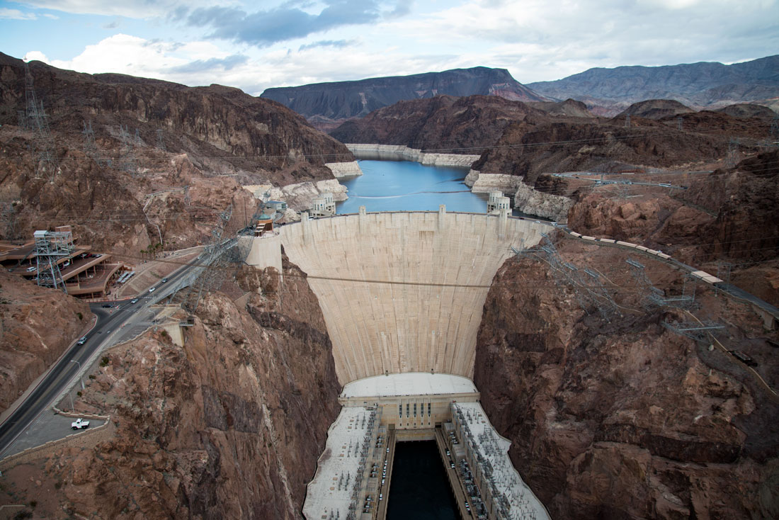
Hoover Dam.
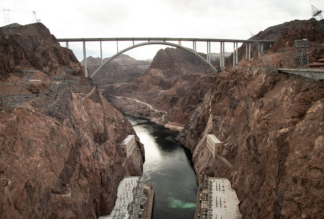
The Mike O’Callaghan-Pat Tillman Memorial Bridge.
The Colorado River then turns south, defining the Arizona-Nevada and Arizona-California borders as it flows into Mexico. Along the river and its tributaries are a system of dams, reservoirs and aqueducts that provide water for 40 million people. The dams regulate the supply of electricity to many areas of the West.
Along the way, the river provides water for many towns, the Salt River Valley of Arizona and metropolitan southern California. At Imperial Dam, more than 90 percent of the remaining flow from the river is diverted to irrigate the major winter agricultural region of Imperial Valley in California. Below this dam, what remains of the river is diverted to the intermittent Gilla River. The remaining flow is diverted to irrigate Mexico’s fertile Mexicali Valley. The river usually goes dry in Mexico. It empties into the Gulf of California, but most of the flow at this point is from the Hardy River. The river flows from 14,000 feet in Colorado to sea level at the Gulf of California.
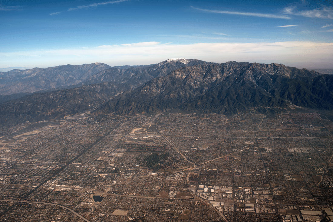
Metropolitan Los Angeles, California. The city and its surrounding area as well as the city of San Diego depend on water diverted from the Colorado River system.
The river’s basin is a remnant of the Pacific Ocean of 100 million years ago. Tectonic forces pushed two plates together to create the Rocky Mountains, with the river along the southwest portion of the range. The tectonic event also diverted the Green River, once a tributary of the Mississippi River, west towards the Colorado River. The Colorado Plateau began to rise between about 55 and 34 million years ago. It may have flowed to Monterrey Bay on the Central Coast of California, but was diverted south by the formation of the Sierra Nevadas. About 5 million years go, the Colorado Plateau reached its present height and the river’s course was set flowing to the Gulf of California. The Grand Canyon was created by the river as the plateau rose.
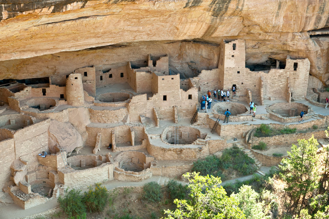
The ancient ruins of Mesa Verde, which was part of the San Juan River system. The San Juan River is a tributary of the Colorado River.
Humans are believed to have inhabited the Colorado River Basin for 12,000 years, but large agricultural societies didn’t form until the early centuries A.D. Among them were the ancient Puebloans, and the Hohokam culture who developed complex irrigation systems including large dams. In the 14th century, their civilizations collapsed and they migrated to become the predecessors of the Hopi, Zuni, Laguna and Acoma people of New Mexico. Navajos migrated from the north to the Colorado River Basin in about 1025 A.D. before the Puebloans left and learned irrigation skills from them. The Navajos became the dominant Native American tribe in the basin, living in Arizona, New Mexico, Utah and Colorado. Other tribes in the basin and along the river tributaries include Mohave, Utes, Apache, and Pima among others.
Spanish explorers mapped and claimed the river basin area in the 16th century, and it briefly became part of Mexico from 1821-46 before most of it came under U.S. control. My family’s Colorado ranch was a summer hunting ground for Utes who camped and hunted there into the early 20th century. My family had friendly relations with them and thought there was ample space and game on the ranch for them and the Utes to share it. This attitude was common among ranchers in this area, but not in many areas of the West. The U.S. government forced Native Americans off their traditional lands and onto reservations, mostly ignoring the tribes' water rights. The four most prominent tribes are now known as the Colorado River Indian Tribes. Ten Native American tribes in the basin now hold or claim water rights to the river and the U.S. government has taken some action to develop the reservations’ water resources. However, the Navajo continue to seek expansion of their water rights because many of their reservations’ inhabitants must haul water by truck to their homes. They have filed legal claims against the governments of Arizona, New Mexico and Utah for increased water rights and some claims have been successful.
Native Americans and Europeans traded furs along the river in the 19th century, and mountain man Jedediah Smith explored the lower Colorado in 1825. The U.S. army looking for a river route to supply its remote post of Fort Yuma explored the river in the 1850s and established a steamboat route on the river in 1852. Steamboats became the main means of trade, travel and communication on the river until the railroads entered the basin in the 1870s. In the 1870s, one-armed Civil War veteran John Wesley Powell led an expedition to run Green River and Colorado River. Three of his men who thought the trip through the Grand Canyon was suicidal pulled out and were killed by Native Americans while Powell and the others successfully navigated the canyon. In 1871, he explored other parts of the Colorado and Green rivers, including Glen Canyon and Flaming Gorge. Lake Powell was named for him.
Mormons built early settlements and ferries along the river and developed the Colorado Basin’s irrigation on a large scale with dams and canals to irrigate crops. They also built well-known ferry crossings such as Lee’s Ferry, established by John D. Lee in the early 1870s after he fled Utah because he was held responsible for the Mountain Meadows Massacre of 120 wagon train emigrants. Lee was executed for the massacre in 1877. The ferry operated until the Navajo Bridge across the river was built in 1928. The U.S. government set up a gauge to collect streamflow records there which later became the factual basis for allocating the river’s water.
Gold and silver strikes brought settlers like my family to the Upper Colorado River Basin, and many mining towns grew up near the river and its tributaries. My family was involved in mining in Colorado until the 1950s. Mining still contributes to the economy of the Colorado River Basin and is an environmental issue because of mine drainage pollution in streams and rivers.
The river wasn’t consistently named the Colorado River until 1921, when the portion between the Grand River and Green River was renamed the Colorado River. Before that, the section called the Colorado River was outside the state of Colorado.
Water disputes in the arid West are a fact of life. The Colorado River system is water rights writ large. A complicated series of international and interstate treaties and federal, state and local agencies governs the allocation of the water along the river and its tributaries. To manage the water, supply electricity and eliminate flooding along the water, dams were built along the river and its tributaries between 1910 and 1970.
Before the dams, the river’s flow was inconsistent as it largely comes from mountain snowmelt that begins in April and peaks in May and June. Most of the water comes from the Gunnison, Green and San Juan rivers, with only about ten percent from groundwater and summer storms. The river and its tributaries drain parts of Colorado, New Mexico, Wyoming, Utah, Nevada, California and Arizona, which are all parties to the Colorado River Compact, which divided half of the river’s flow to the Upper Basin and the Lower Basin. Each was given rights to 7.5 million acre feet of water per year. In 1944, a U.S.-Mexico treaty allocated 1.5 million feet of the river’s water per year to Mexico.
About 13 million people live in the Colorado River Basin, with Phoenix, Arizona, and Las Vegas, Nevada, the largest cities. Tucson, Arizona, St. George, Utah, and Grand Junction, Colorado, also are significant population centers. The population of the basin is among the fastest growing in the United States.
Today, more than 29 major dams and hundreds of miles of canals provide irrigation to 4 million acres of land, supply water to major cities such as Los Angeles, Las Vegas, San Diego, Denver, and Phoenix and meet peaking power demands by generating more than 12 billion kilowatt hours of hydroelectricity every year.
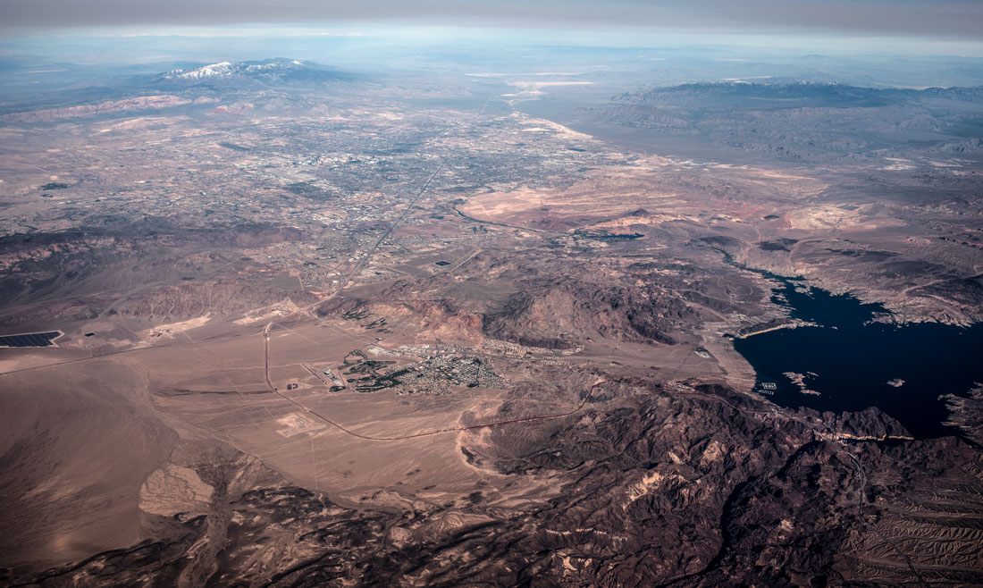
This photo shows Lake Mead and Hoover Dam on the right and the city of Las Vegas on the left.
Eighty percent of Colorado’s population lives east of the Rockies while 75 percent of precipitation falls west of them, so among the large water projects were diversion ones to take water from the river to the east side.
Among the major dams are Hoover Dam, which created Lake Mead as the United States’s largest artificial lake. The dam was the world’s tallest when it was constructed and it had the world’s largest hydroelectric power plant.
Imperial Dam diverts nearly all of the Colorado's flow into two irrigation canals. The All-American Canal is the largest irrigation canal in the world and supplies water to Imperial Valley. It has enabled the warm, sunny valley to become one of North America’s most productive agricultural regions. The second canal, the Gila Gravity Main Canal, irrigates land in southwestern Arizona.
The Roosevelt and Coolidge dams provide water for large-scale agricultural and urban development. The Colorado River Aqueduct provides water for the Los Angeles Metropolitan area and the San Diego Aqueduct branch for the San Diego area.
In 1956, the construction of large dams on the Colorado River and the tributaries of Green, Gunnison and San Juan rivers was initiated. Environmental groups got the government to drop plans for two dams on the Green River within Dinosaur National Monument, but not for dams at Flaming Gorge and Glen Canyon.
The Pacific Southwest Water Plan was an attempt to divert water to the Colorado Basin from other river basins in the wetter northwestern United States to meet the growing population needs of Arizona, California, Nevada and Mexico.
The Central Arizona Project irrigates more than 830,000 acres and provides water from the Colorado River to more than 5 million people from Phoenix to Tucson.
Environmental impacts
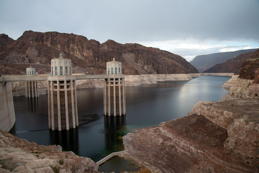
This surreal photo of the Hoover Dam looks like it belongs in a science fiction film. It is a reminder that the amazing technology that delivers water from the Colorado River to major population and agricultural areas comes at a price.
Sediment has become a major environmental issue. Before the dam system, the river carried sediment to wetlands and riparian areas in the Colorado River Delta, which was the largest desert estuary in North America. Most of the sediment now is deposited in Lake Powell, with the remainder at Lake Mead. This has changed the color of the river from reddish to clear green and destroyed habitat that has caused the numbers of fish, shrimp and sea mammals in the Gulf of California to decline dramatically. The Colorado River and its tributaries' extensive riparian zones have been affected by water diversion projects in many places. These areas support hundreds of species of birds. Animals such as jaguars have been threatened by the environmental impact as well.
More than 1,600 species of plants grow in the Colorado River watershed, including large evergreens that once were abundant in high elevations. Runoff from these areas nourished grassland in river valleys that supported large mammals such as buffalo and antelope. Now there is only dry desert in some of those areas.
The dams have contributed to the extinction of four species of fish and severe declines in the populations of 40 of the 49 native species that once were abundant in the river. All are unique to the Colorado River system. Another 40 species were introduced during the 19th and 20th centuries, mainly for sport fishing. Fisheries have declined in many streams that are part of the river system because of polluted runoff from mining and agriculture.
Another major issue is increased salinity, which corrodes pipes in agricultural and urban areas and damages crops. A desalination plant has been built to reduce the salinity and other measures have been taken, but salinity remains a problem.
Agricultural runoff that contains pesticides has killed fish in the lower river and in streams and lakes near agricultural lands. As a result, the New and Alamo rivers and the Salton Sea are among the most polluted bodies of water in the United States. The problem also affects the Grand Valley in Colorado.
Large dams such as Hoover and Glen Canyon release water from lower levels of their reservoirs, which has resulted in stable, cold temperatures over long stretches of the river. This is a change from once-varying temperatures along the river. As a result, native fish populations have declined and vegetation growth has disrupted riverside habitat. The temperature change has made the river more dangerous for boaters as people are at higher risk of dying from hypothermia in the water. Rockslides also have built up because the dams control flooding that once would have washed the slides away.
Irrigation, diversions, evaporation from reservoirs, natural runoff and likely climate change have resulted in a reduction in flow from the river. To deal with the river running dry in Mexico, the United States has begun to store some of Mexico’s water allotment during wet years and release it in a planned way to allow some of the river’s water to flow to the ocean.
Probably the most serious problem is that studies indicate that more water is being allocated to river users than actually flows through the river. This is more severe in drought years. Between 2000 and 2012, the river basin produced normal or above average runoff in only four years. The reservoirs fell to historic lows, with Lake Powell falling to a third of its capacity in 2005. Amid a general trend of earlier snowmelt and reduced precipitation, average reservoir storage has declined by 32 percent.
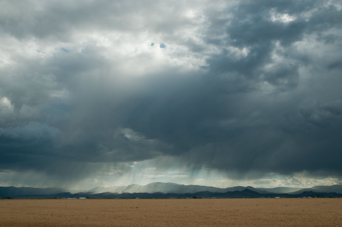
Colorado's famous summer storms contribute only a small proportion of the river's water. Most of it comes from snowmelt.
The Colorado River and its tributaries have been world-famous tourist attractions for well over a century. Members of my family back at least four generations picked up extra cash boarding and cooking for tourists on their ranches, working as hunting and fishing guides, selling fishing licenses and other tourist-related activities.
The river and its tributaries are famous for whitewater runs. The U.S. Forest Service limits river traffic in the Grand Canyon for environmental reasons, and the waiting list to run it is more than ten years long. River traffic in Cataract Canyon and other reaches of the Colorado River is even heavier. About 60,000 boaters run one short section above Radium, Colorado, every year, and a section in Utah gets about 80,000 visitors yearly.
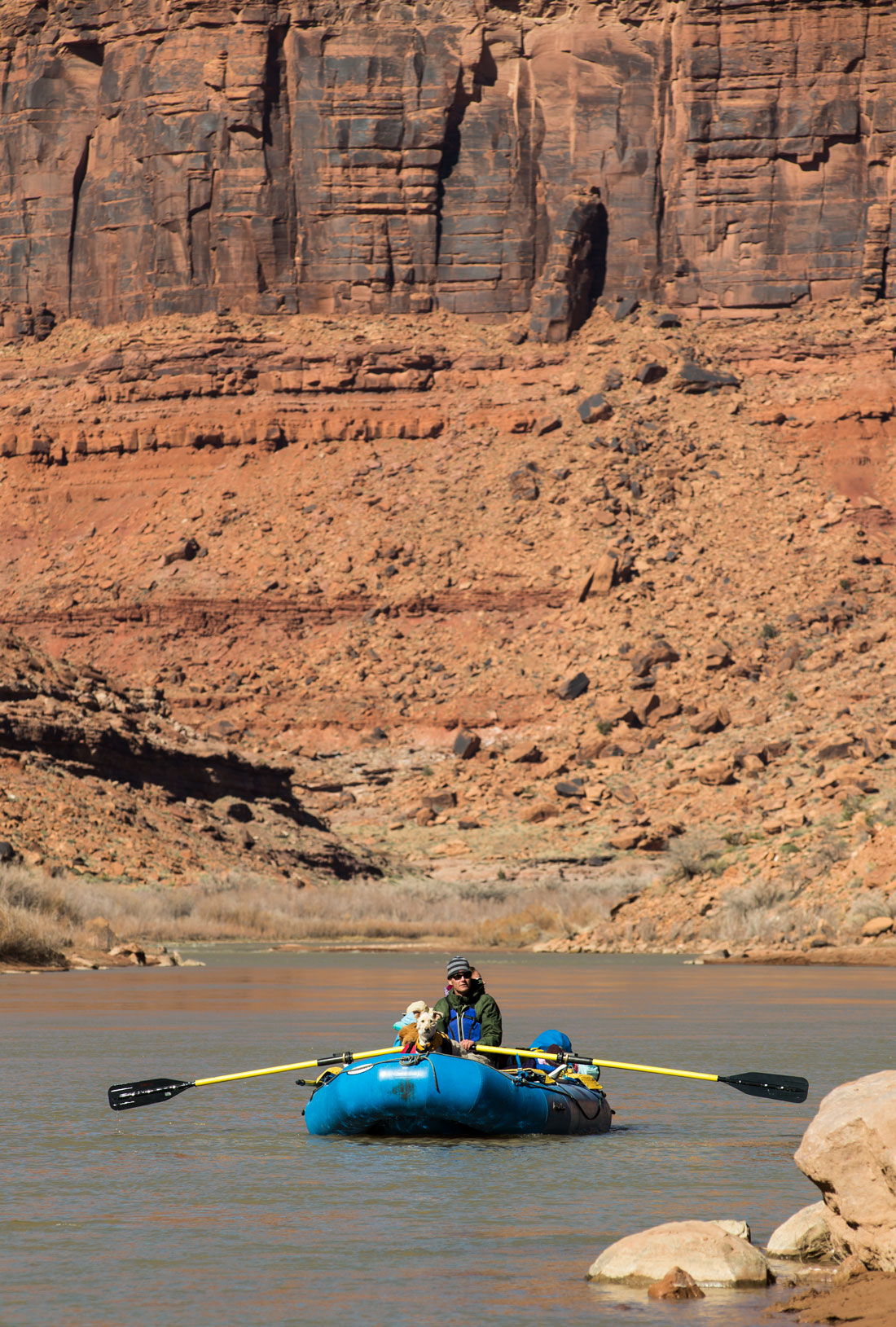
Boaters on the Colorado River.
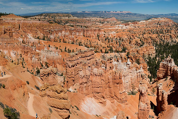
Eleven U.S. national parks – Arches, Black Canyon of the Gunnison, Bryce Canyon, Canyonlands, Capitol Reef, Grand Canyon, Mesa Verde, Petrified Forest, Rocky Mountain, Saguaro, and Zion are in the river’s watershed. There also are many national forests, state parks and recreation areas that are popular places for hiking, backpacking, camping, skiing, and fishing. Houseboating and water-skiing are popular on reservoirs. Lake Powell and Glen Canyon National Recreation Area have about two million visitors annually while Lake Mead and its national recreation area get about 8 million. The Colorado River recreation industry employs about 250,000 people and contributes $26 billion to the economy yearly. At the same time, the influx of visitors brings environmental challenges.
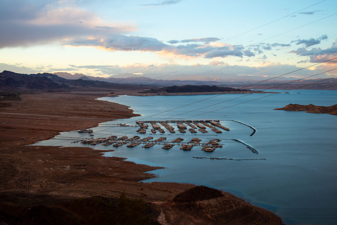
Boats at Lake Mead.
Related photos:
Check out these related items
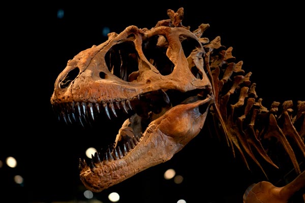
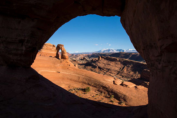
Utah’s Rock Stars
Utah's spectacular scenery harbors one of the world's most complete and diverse dinosaur fossil records.
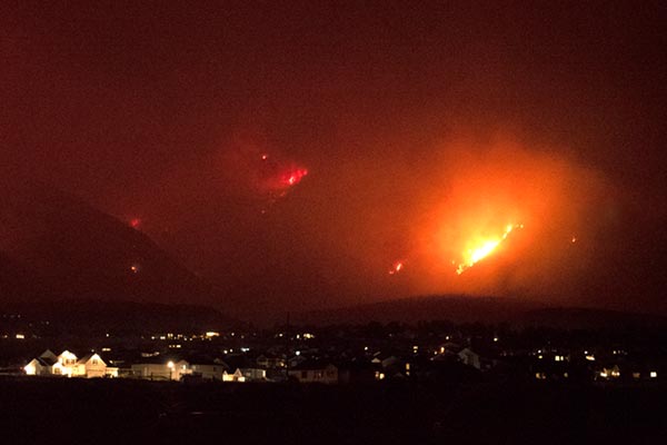
Fire! Is this the new norm?
Are record wildfires the new norm in the West? As fires threaten homes and communities, here are answers to questions about them.
Visit Utah’s National Parks
Utah state and local governments and organizations are chipping in to keep national parks operating during the government shutdown.
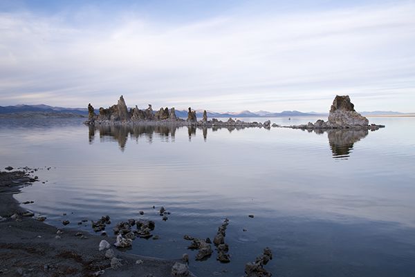
The Road Less Traveled
There's an alternative to the standard boring I-15 southern and I-80 northern routes across Nevada.
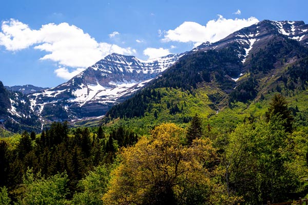
Springtime in the Rockies
It's springtime in Utah's Rockies. Photographer Forrest Anderson captured the stunning scenery.